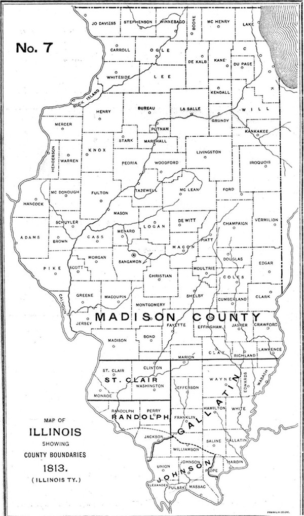
1813 Illinois County Formation Map
Try our genealogy search engine
1812--COUNTY BOUNDARIES RE-ADJUSTED
By Territorial Legislature
AN ACT ESTABLISHING THE BOUNDARY LINES OF GALLATIN COUNTY
Be it enacted by the Legislative Council and House of Representatives of the Illinois, and it is hereby enacted by the authority of the same: That the line of Gallatin County do begin at the mouth of Lusk's Creek on the Ohio River, running up with said creek to Miles' old Trace; thence along said Trace to the meridian line which runs north from the mouth of the lower line of Madison County, thence with said line to the dividing line between Illinois and Indiana Territories; thence with said line to the north of the Wabash, and thence down the Ohio to the beginning.
Approved Dec. 11, 1813.
AN ACT ESTABLISHING THE BOUNDARY LINE BETWEEN THE COUNTIES OF RANDOLPH AND ST. CLAIR
Be it enacted by the Legislative Council and House of Representatives of the Illinois Territory and it is hereby enacted by the authority of the same: That the boundary line between St. Clair, Randolph and Gallatin Counties shall begin at the Mississippi River on the line between townships 2 and 4 south of the base line (which is near Cahokia); thence running east along said line between townships 3 and 4 aforesaid to the meridian line which runs north from the mouth of the Ohio River; thence along said meridian line until it intersects the lower (or southern) boundary of the county of Madison. This act to be in force from and after its passage.
Approved Dec. 11, 1813.
[Territorial Laws 1813; Manuscript Nos. 428, 429; unpublished.]