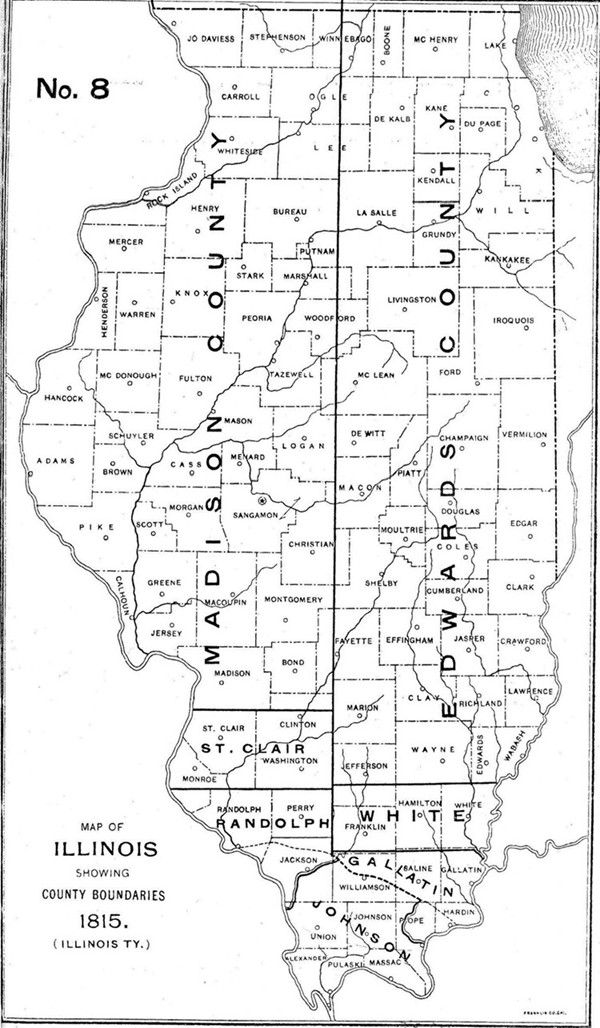
1814-1815 Illinois County Formation Map
Try our genealogy search engine
1814-1815--Edwards AND WHITE
As counties of Illinois Territory
AN ACT FOR THE DIVISION OF GALLATIN COUNTY
Be it enacted by the Legislative Council and House of Representatives of the Illinois Territory and it is hereby enacted by authority of the same. That all that tract of country within the following boundaries (to-wit): Beginning at the mouth of Bompast [Bon Pas] creek on the big Wabash and running thence due west to the meridian line which runs due north from the mouth of the Ohio River; thence with said meridian line and due north until it strikes the line of Upper Canada; thence with the line of Upper Canada to the line that separates this Territory from the Indiana Territory; and thence with said dividing line to the beginning shall constitute a separate county, to be called EDWARDS.
Approved this 28th day of November, 1814.
[Territorial Laws, 1814, Pope's Digest, p. 85.]
AN ACT FOR THE DIVISION OF GALLATIN COUNTY
Be it enacted by the Legislative Council and House of Representatives of the Illinois Territory, and it is hereby enacted by authority of the same, That all that tract of country within the following boundaries (to-wit): Beginning at the mouth of the Little Wabash, running up the same to Joseph Boon's mill; thence due west to the third principal meridian; thence with Edwards County line east to the Big Wabash, thence down the same to the beginning shall constitute a separate county, to be called WHITE.
APPROVED this 9th day of December, 1815.
[Territorial Laws, 1815-16, p. 5.]